 Filter: Categories of Wisconsin Historical Images
Filter: Creator Name of Berrien, John Macpherson
Filter: Categories of Wisconsin Historical Images
Filter: Creator Name of Berrien, John Macpherson

| Date: | 1836 |
|---|---|
| Description: | A detailed map of the mouth of the Kewaunee River, showing the geological composition of the Lake Michigan shoreline and the various water depths in the ar... |
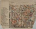
| Date: | 1955 |
|---|---|
| Description: | These 24 plat maps of the Town of Newton, Manitowoc County, Wisconsin, show soil type; mortgages in force as of January 1, 1932; land warrants holders; mor... |

| Date: | 1836 |
|---|---|
| Description: | This 1836 map consists chiefly of a detailed map of the the mouth of the Sheboygan River. An inset map of the region and cross section diagrams of the pier... |
| Date: | 1900 |
|---|---|
| Description: | This map shows distances along the road, rivers, Indian trails between a shantytown south of Navarino (Green Bay)and Fort Howard. It also shows Lake Winneb... |
If you didn't find the material you searched for, our Library Reference Staff can help.
Call our reference desk at 608-264-6535 or email us at: